
PlanetiQ Secures $3.3 Million NASA Task Order for Advanced GNSS-PRO and Ionospheric Data
NASA acquisition will deliver PlanetiQ’s high-SNR GNSS polarimetric radio occultation and ionospheric observations to support atmospheric and space weather research
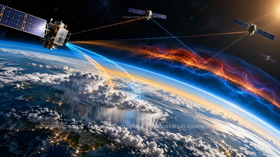
PlanetiQ has secured a $3.3 million task order from NASA to provide advanced GNSS Polarimetric Radio Occultation (GNSS-PRO) and ionospheric Total Electron Content (TEC) data under NASA’s Commercial Satellite Data Acquisition (CSDA) program.
The acquisition will give NASA researchers access to high signal-to-noise ratio (SNR) observations designed to support research into precipitation, atmospheric conditions, and space weather.
The award builds on NASA’s June 2026 selection of PlanetiQ as a CSDA On-Ramp 2 task order holder for the company’s GNSS-PRO data, expanding the role of commercial satellite-derived observations in NASA’s atmospheric and space science research.
Taking GNSS Radio Occultation Beyond Atmospheric Profiles
GNSS radio occultation (RO) has become an important tool for observing Earth’s atmosphere. The technique measures how signals transmitted by navigation satellites bend and slow as they travel through the atmosphere, allowing scientists to derive detailed profiles of atmospheric properties.
PlanetiQ’s GNSS-PRO capability extends this approach by examining both the horizontal and vertical components of GNSS signals.
This dual-polarization approach, commonly referred to as polarized radio occultation (PRO), provides additional information about precipitation along the signal path. In particular, the measurements can help researchers characterize rain and snowfall at different altitudes, creating a more detailed picture of precipitation structure within the atmosphere.
“GNSS-PRO gives us a new way to observe the atmosphere,” said Dr. E. Robert Kursinski, Chief Scientist at PlanetiQ. “This acquisition gives NASA researchers an opportunity to create applications using this globally distributed data source to quantify precipitation and clouds at a high vertical resolution.”
The capability could provide researchers with another source of globally distributed atmospheric observations, complementing existing Earth-observation techniques and potentially improving understanding of precipitation and cloud processes.
Mapping the Ionosphere for Space Weather Research
The NASA acquisition also includes ionospheric Total Electron Content (TEC) measurements from PlanetiQ.
TEC measurements quantify the total number of electrons along the signal path between a GNSS satellite and PlanetiQ’s receiving satellites. Monitoring these electron concentrations provides insight into the state of the ionosphere and how it changes over time.
That information is particularly important for space weather research.
Disturbances in the ionosphere can alter the propagation of GNSS signals and affect navigation, positioning, timing, communications, and other space-based and terrestrial systems. By providing additional observations of ionospheric conditions, PlanetiQ’s TEC data can help researchers study these disturbances and their potential impacts.
Commercial Satellite Data Expands NASA’s Research Capabilities
The award highlights the growing role of commercial satellite data in government science and Earth-observation programs.
Through the CSDA program, NASA is increasingly leveraging commercially generated datasets to complement government-owned observation capabilities and provide researchers with new sources of information about Earth’s atmosphere and near-Earth environment.
For PlanetiQ, the $3.3 million task order represents a further expansion of its role in supplying specialized GNSS-derived observations for scientific applications.
By combining high-SNR GNSS-PRO observations with ionospheric TEC data, the acquisition gives NASA researchers access to datasets spanning two closely connected domains: Earth’s atmosphere and the ionized environment surrounding the planet.
As atmospheric monitoring and space weather forecasting become increasingly important to navigation, communications, climate research, and space operations, commercial GNSS-based observation technologies are emerging as an increasingly valuable component of the broader space-data ecosystem.


Comments